The book I’m currently rewriting contains a shanty town that plays an important role in the story, so let’s take a look at some ghost towns…
Britain’s Atlantis
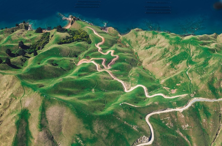
It’s real name is Dunwich, in Suffolk, England. This was a busy port in medieval times and it was the capital of East Anglia (or the Kingdom of the Eastern Angles) in Anglo-Saxon times.
It also contained large churches and monasteries and was a hub for religious activity. The town grew prosperous through ship-building and trade and had a good fishing fleet.
Violent storms have destroyed much of Dunwich and some of it has been submerged by the North Sea. All that remains is a ruined 13th century Franciscan friary on a cliff-edge, the chapel of a medieval leper hospital, a tiny village consisting of 120 people, and a museum about the town’s history.
The name “Dunwich” may have been taken from here by H.P. Lovecraft for the fictional town of the same name near Massachussetts in his cosmic horror story “The Dunwich Horror.”
Boreraig, Isle of Skye (Scotland)
The residents of Boreraig were forced to leave by rich landowners in the 1850s so their sheep had extra room to graze. This was a widespread thing known as the Highland Clearances. Some of them even burned the roofs of the cottages to make sure the villagers wouldn’t return.
The farmland near Boreraig was abandoned in the 20th century. Now all that remains are a few collapsed stone houses, weathered and worn, forming part of a popular hiking route. There is a church topped with grass, and piles of grey rock chipped from the old Marble Quarry.
Tyneham, Dorset (England)
Known as “Dorset’s lost village,” this abandoned place is so well-preserved it appears to have frozen in time. In December 1943, it was acquired by the army for training purposes in World War II, and the original residents were only given a month to vacate the area.
It was supposed to be a temporary evacuation, but the army made a mandatory purchase order after the war, which meant the villagers were never allowed to come back.
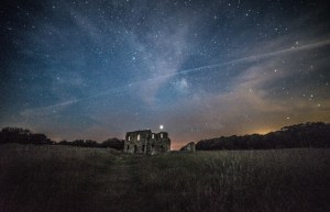
It is still being used by the army, but parts of it are open to the public on holidays and weekends. There are roofless stone cottages full of daily objects left behind and plants growing wild, an old phonebox, and an empty school that has intact workbooks in it. Postcards are dotted about all over the village with stories of the former residents written on their backs.
Hallsands, Devon (England)
This tiny fishing village on the South Devon coast was attacked by a ferocious storm on January the 26th, 1917. Waves and high winds poured across the coast, flooding buildings and submerging them in freezing cold water.
By midnight, four houses were entirely gone. The inhabitants packed their bags and evacuated to the nearby cliffs.
In 24 hours, 29 houses were obliterated, along with the careers and belongings of all the villagers.
Before World War I, vast amounts of shingle had been removed from the coast nearby to enlarge Plymouth Docks, and that shingle had been protecting Hallsands from the water.
Bits of some houses and the old chapel still exist, but visitors have to see the village from a viewing platform at a distance — erosion has made it too dangerous to physically set foot there!
Hirta, St Kilda (Scotland)
St Kilda is a volcanic archipelago off the Western coast of the Outer Hebrides. There are four islands – Hirta, Soay, Borerary, and Dun. Hirta is the biggest.
Between 4000 and 5000 years ago, Hirta was settled by its first humans who made a self-sufficient civilisation. The other three islands didn’t have anyone living on them. Needless to say life on the island was difficult, and its last inhabitants left for the mainland in the 1930s.
Fragments of the settlement can still be seen, along with a huge colony of Atlantic puffins! In 1986 it became a dual UNESCO World Heritage site.
Wharram Percy, East Yorkshire (England)
This is one of the biggest and well-preserved medieval villages in Britain, located in a valley in the Yorkshire Wolds.
It may have been founded in the 9th or 10th centuries and was recorded in the Domesday Book under the name “Warran.” It had its heyday from the 12th to the 14th century.
A noble family named “Percy” owned the land and also lived there. Wharram Percy was occupied for six centuries then abandoned in 1500 — the last few families were kicked out to make space for sheep-grazing.
The only medieval building left is a ruined church, along with the foundations of two manor houses and about forty peasant homes with outbuildings, somewhat visible but reclaimed by grass.
Since 1948, Wharram Percy has been heavily researched, and is the most famous abandoned medieval village in Europe.
Imber, Wiltshire (England)
Imber on Salisbury Plain was also taken over by the military.
In 1943, the MoD evacuated Imber’s community, giving them forty-seven days’ notice to get out and make way for a training ground for American soldiers.
After the army bought the village and its environs, Salisbury Plain became the biggest military training ground in the United Kingdom.
The situation was supposed to be temporary but after the war ended, the villagers were not allowed to go back and Imber was permanently taken over by the army.
Today, the village is a shell of its old self, though its empty buildings are still used for military training. The village is mostly closed, but sometimes opens to the public on certain days of the year.
Tide Mills, East Sussex (England)
This used to be a cornmill village hundreds of years ago, founded in the 1760s after the Duke of Newcastle allowed three West Sussex corn merchants to build a tidal mill and a dam, then the village expanded around it. The mill was in business for over 100 years and closed in 1883.
Because of bad living conditions, Tide Mills was condemned in 1937, and anyone who still refused to leave it was forcibly evicted.
It was empty by 1940, and not much of it is left now apart from a few house foundations, flint walls, and three arches under the mill. Nature has taken it back into her embrace, plants covering most of the stones and birds nesting in the fields close by.
Samson, Isles of Scilly (England)
Samson is the biggest uninhabited island in the Scilly Isles. It’s named after Saint Samson of Dol, one of the people who are said to have founded the Kingdom of Brittany. He visited the islands in the 6th century.
Samson was lived in by farmers and fishermen until 1855, when Augustus Smith, (the Lord Proprietor of the islands) decided to move the small and starving population to other islands.
Samson contains more prehistoric sites per acre than any of the other islands. Multiple ruins dot the landscape – old burial grounds, roundhouses, 19th-century cottages, graves.
Samson has also been part of a Site of Special Scientific Interest ever since 1971 because it has biological characteristics that make it worth studying – especially the colonies of seabirds that are now its current residents.
Hallaig, Isle of Raasay (Scotland)
Another village that fell foul of the Highland Clearances. Situated on the Isle of Raasay, this was a lively and friendly community until the 1850s, when the population was evicted so the land could be utilised for sheep-farming.
The village became famous after the Gaelic poet Sorley MacLean (or Somhairle MacGill-Eain) penned Hallaig, a poem inspired by it – some of his relatives had been affected by the mass eviction. It was MacLean’s best-known poem and he’s now thought of as one of the great Scottish poets from the 20th century.
‘Tha tìm, am fiadh, an coille Hallaig’
Tha bùird is tàirnean air an uinneig
trom faca mi an Àird an Iar
’s tha mo ghaol aig Allt Hallaig
’na craoibh bheithe, ’s bha i riamh
eadar an t-Inbhir ’s Poll a’ Bhainne,
thall ’s a-bhos mu Bhaile Chùirn:
tha i ’na beithe, ’na calltainn,
’na caorann dhìrich sheang ùir.
Ann an Sgreapadal mo chinnidh,
far robh Tarmad ’s Eachann Mòr,
tha ’n nigheanan ’s am mic ’nan coille
a’ gabhail suas ri taobh an lòin.
Uaibhreach a-nochd na coilich ghiuthais
a’ gairm air mullach Cnoc an Rà,
dìreach an druim ris a’ ghealaich –
chan iadsan coille mo ghràidh.
Fuirichidh mi ris a’ bheithe
gus an tig i mach an Càrn,
gus am bi am bearradh uile
o Bheinn na Lice fa sgàil.
Mura tig ’s ann theàrnas mi a Hallaig
a dh’ionnsaigh Sàbaid nam marbh,
far a bheil an sluagh a’ tathaich,
gach aon ghinealach a dh’fhalbh.
Tha iad fhathast ann a Hallaig,
Clann Ghill-Eain ’s Clann MhicLeòid,
na bh’ ann ri linn Mhic Ghille Chaluim:
chunnacas na mairbh beò.
Na fir ’nan laighe air an lèanaig
aig ceann gach taighe a bh’ ann,
na h-igheanan ’nan coille bheithe,
dìreach an druim, crom an ceann.
Eadar an Leac is na Feàrnaibh
tha ’n rathad mòr fo chòinnich chiùin,
’s na h-igheanan ’nam badan sàmhach
a’ dol a Clachan mar o thùs.
Agus a’ tilleadh às a’ Chlachan,
à Suidhisnis ’s à tir nam beò;
a chuile tè òg uallach
gun bhristeadh cridhe an sgeòil.
O Allt na Feàrnaibh gus an fhaoilinn
tha soilleir an dìomhaireachd nam beann
chan eil ach coitheanal nan nighean
a’ cumail na coiseachd gun cheann.
A’ tilleadh a Hallaig anns an fheasgar,
anns a’ chamhanaich bhalbh bheò,
a’ lìonadh nan leathadan casa,
an gàireachdaich ’nam chluais ’na ceò,
’s am bòidhche ’na sgleò air mo chridhe
mun tig an ciaradh air na caoil,
’s nuair theàrnas grian air cùl Dhùn Cana
thig peilear dian à gunna Ghaoil;
’s buailear am fiadh a tha ’na thuaineal
a’ snòtach nan làraichean feòir;
thig reothadh air a shùil sa choille:
chan fhaighear lorg air fhuil rim bheò.
Translation:
‘Time, the deer, is in the wood of Hallaig’
The window is nailed and boarded
through which I saw the West
and my love is at the Burn of Hallaig,
a birch tree, and she has always been
between Inver and Milk Hollow,
here and there about Baile-chuirn:
she is a birch, a hazel,
a straight, slender young rowan.
In Screapadal of my people
where Norman and Big Hector were,
their daughters and their sons are a wood
going up beside the stream.
Proud tonight the pine cocks
crowing on the top of Cnoc an Ra,
straight their backs in the moonlight –
they are not the wood I love.
I will wait for the birch wood
until it comes up by the cairn,
until the whole ridge from Beinn na Lice
will be under its shade.
If it does not, I will go down to Hallaig,
to the Sabbath of the dead,
where the people are frequenting,
every single generation gone.
They are still in Hallaig,
MacLeans and MacLeods,
all who were there in the time of Mac Gille Chaluim:
the dead have been seen alive.
The men lying on the green
at the end of every house that was,
the girls a wood of birches,
straight their backs, bent their heads.
Between the Leac and Fearns
the road is under mild moss
and the girls in silent bands
go to Clachan as in the beginning,
and return from Clachan,
from Suisnish and the land of the living;
each one young and light-stepping,
without the heartbreak of the tale.
From the Burn of Fearns to the raised beach
that is clear in the mystery of the hills,
there is only the congregation of the girls
keeping up the endless walk,
coming back to Hallaig in the evening,
in the dumb living twilight,
filling the steep slopes,
their laughter a mist in my ears,
and their beauty a film on my heart
before the dimness comes on the kyles,
and when the sun goes down behind Dun Cana
a vehement bullet will come from the gun of Love;
and will strike the deer that goes dizzily,
sniffing at the grass-grown ruined homes;
his eye will freeze in the wood,
his blood will not be traced while I live.
Cwmorthin, Gwynedd (Wales)
This old mining village in a valley in Gwynedd saw a lot of action in the 19th-century slate rush.
Cwmorthin held many working-class families who joined the farmers that already resided in the area for many years. It’s reckoned that some kind of community has been here since the 11th century.
After the slate industry declined by the 1940s, the Victorian town was deserted. All that remains now are some decrepit cottages, old quarry buildings, and a farmhouse. The place overlooks a nice lake, and the surroundings make it look so mystical its popular with hikers.
Mardale Green, Cumbria (England)
In August 1935, Mardale Church held one last service before the inhabitants of Mardale Green had to pack their belongings and leave for ever.
The church was demolished shortly after, the bodies in the graveyard dug up and reinterred elsewhere, along with the houses, farm buildings, and the village pub.
The remains of Mardale Green were then flooded – deliberately. It was all part of a plan to get water to nearby cities using the Haweswater Reservoir.
At the time of writing this, the remnants of the destroyed village resurface every few years whenever the water levels in the reservoir become low – usually because of drought or whenever water is in higher demand. When that occurs, ruins of the old church, the demarcations of streets and houses, and a 17th-century bridge can all be seen. That must be quite a surreal sight.
The shanty town in the second book of The Nighthunter series has a shanty town in it (not exactly a ghost town, but it is surrounded by ghosts). It’s name is Coven, and you can find out more about it here.
